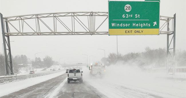
El Nino Pattern Points to Warmer, Wetter Winter and Lower White Christmas Odds in Iowa
Iowans might want to trade their heavy snowshovels for rain boots this season. According to state climatologist Justin Glisan, charts tracking water temperatures in the eastern Pacific Ocean along the equator point directly toward a historically strong El Nino pattern for the upcoming winter.
When sea surface temperatures climb two degrees or more above the 30-year average, meteorologists classify the event as a strong El Nino. Glisan notes that current readings in the eastern Pacific are approaching four degrees above average. That extreme warmth sets the stage for a distinct regional shift characterized by milder temperatures, decreased snowfall, and an uptick in winter rain.

The state has seen this script before. During the last strong El Nino event for wintertime, which was 2023 into 2024, temperatures averaged about eight degrees above normal, and it ranked as the second warmest winter on record, as well as the third wettest winter on record. For residents wondering about holiday traditions, these shifting dynamics carry a clear consequence.
A wetter winter dominated by rain rather than snow sharply reduces the probability of a white Christmas across the state. Glisan defines a white Christmas as having at least one inch of snow on the ground on December 25th. According to National Weather Service records, Des Moines has reached that one-inch threshold on just 40 of the past 83 Christmases—falling just under the halfway mark historically.
That baseline probability has already eroded by five to ten percent over the last 20 to 30 years independent of tropical Pacific cycles. When layered on top of a strong El Nino, the downward trend on holiday snowfall becomes even more pronounced, leaving residents with lower odds of a snow-covered landscape as December 25 approaches.
Related reading

New 2027 Ford Super Duty F-350 DRW LARIAT 4X4 Crew Cab – Ken Garff Ford Cheyenne
2027 Ford Super Duty F-350 DRW LARIAT Arrives at Ken Garff Ford Cheyenne A brand-new 2027 Ford Super...

Sun Belt Announces 2026 Women’s Soccer Championship Bracket
The Foley Sports Tourism Complex in Foley, Alabama, is preparing to host the Sun Belt Women's Soccer Championship...
W.Va. Officials Seek Delay In School Aid Formula Case, Citing Planned Legislative Overhaul
State officials in West Virginia are asking the state Supreme Court of Appeals to pause an active lawsuit...

Orlando Pride’s season comes to end with 1-0 loss at Seattle
Orlando Pride Close Out 2026 Season With 1-0 Defeat at Seattle Reign FC The Orlando Pride wrapped up...