Large swaths of Canada are under weather alerts this Tuesday, as a massive high-pressure system triggers extreme heat and severe thunderstorm risks. Provinces from the Northwest Territories to Quebec face heat warnings, while parts of Ontario and Quebec are under tornado watches due to a severe storm outbreak.
Heat Dome Drives Record-Threatening Temperatures
A sprawling area of high pressure, centered over the United States, is the primary driver behind the widespread heat warnings currently blanketing five provinces and one territory. Meteorologists describe the event as a wide-ranging system pushing temperatures well above seasonal norms.
In Ottawa, residents are bracing for a forecast high of 35 C, which would mark the city’s hottest day of 2026. Toronto is similarly impacted, with expectations that daily heat records could be eclipsed. The intensity of the heat is amplified by high humidity, which pushes the humidex into the mid-40s in many regions. Environment Canada notes that these heat warnings are tiered; northern Ontario regions have lower thresholds for alerts based on historical norms, while southern areas require higher humidex readings to trigger the same yellow-level warnings.
The intensity of the conditions has prompted some businesses to pause operations entirely to protect their workforce. We decided to shut down, essentially, for the next two days,
said Sarah Bowen, social media manager for the Heart and Soul Café in Ottawa. We just want to keep our staff safe. The kitchen temperature is going to get out of hand, even with air conditioning and all the fans running.
Tornado Watches and Severe Storm Threats in Quebec and Ontario
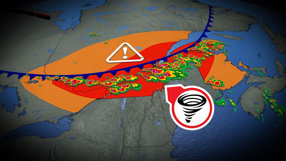
While the heat dominates the central regions, a high-impact storm system is tracking through the St. Lawrence and Ottawa Valleys. Environment Canada has issued an orange tornado watch for south-central Quebec—an uncommon alert level reserved for weather likely to cause significant infrastructure damage or health impacts.
According to The Weather Network, the atmospheric setup includes deep wind shear and increasing helicity, creating conditions favorable for strong tornadoes, large hail up to 4 cm, and damaging wind gusts reaching 120 km/h. The storms are expected to intensify in the afternoon, tracking from north of the St. Lawrence toward the Eastern Townships and northern New Brunswick by the evening.
Officials are urging residents to have a safety plan ready. Make sure that you are in the safest place possible — a secure basement — and wait until everything has passed.
Wildfire Smoke Adds to Air Quality Concerns
The weather crisis is further complicated by wildfire smoke, which has created a double whammy
for residents in parts of Ontario and Quebec. As large-scale weather systems bring heat and humidity, they are also pulling plumes of smoke eastward from active wildfires, particularly in areas west of Thunder Bay and in northern Quebec.

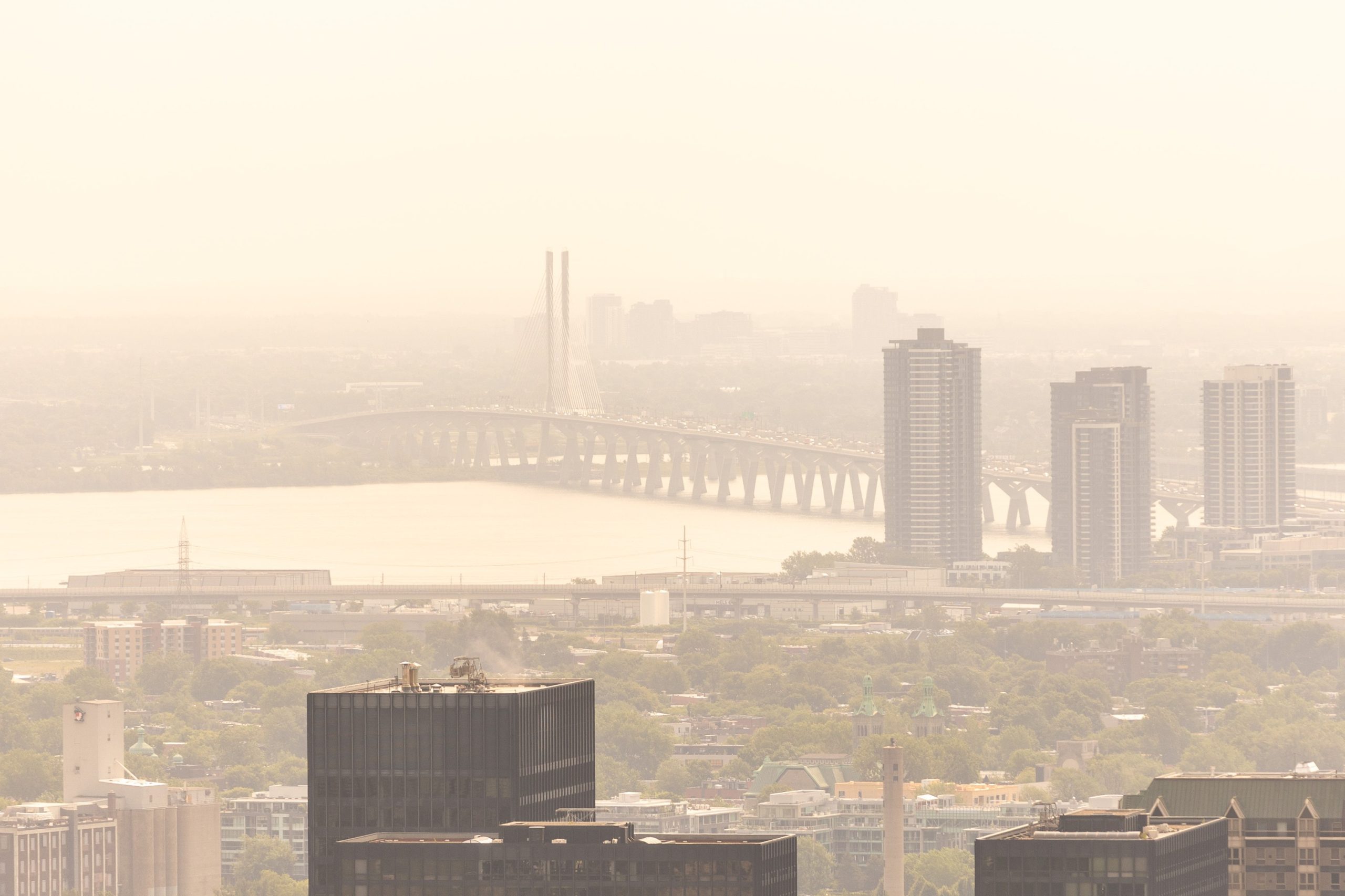
This accumulation of smoke is responsible for the yellowish hue observed in the sky over Montreal on Tuesday morning. While air quality levels were generally considered moderate in the early part of the day, meteorologists warn that local readings could deteriorate quickly under the influence of the smoke. For those with respiratory issues, the combination of extreme heat and diminished air quality presents a significant health challenge, with health officials recommending that residents avoid strenuous outdoor activity and stay hydrated.
While the severe storm activity is expected to diminish overnight, the heat wave remains a persistent concern. Residents in the affected regions are encouraged to monitor local weather alerts continuously, as conditions can change rapidly when the heat dome interacts with the incoming cold front.
Find more reporting in our News section.
Worth a look

Police Find Canada-Returned Couple Dead in Karachi Home
Police found a Canada-returned elderly couple dead inside their North Karachi home.

Nyesom Wike Unveils 2027 Cross-Party Campaign Strategy in Abuja
Federal Capital Territory Minister Nyesom Wike unveiled a cross-party mobilization strategy, declaring himself field commander for President Bola...

Traffic Diversions Set as Zanu-PF Annual Conference Begins in Chinhoyi
Thousands of delegates converge on Chinhoyi for the ruling party’s annual conference, triggering strict traffic diversions on major...
An Coimisiún Pleanála Refuses Creeslough Service Station Planning
An Coimisiún Pleanála has refused planning permission for a service station adjacent to the Creeslough tragedy site in...