A wet and windy pattern has returned across western Washington, bringing a stronger storm set to hit this weekend, according to the FOX 13 Seattle Weather Team and the National Weather Service.
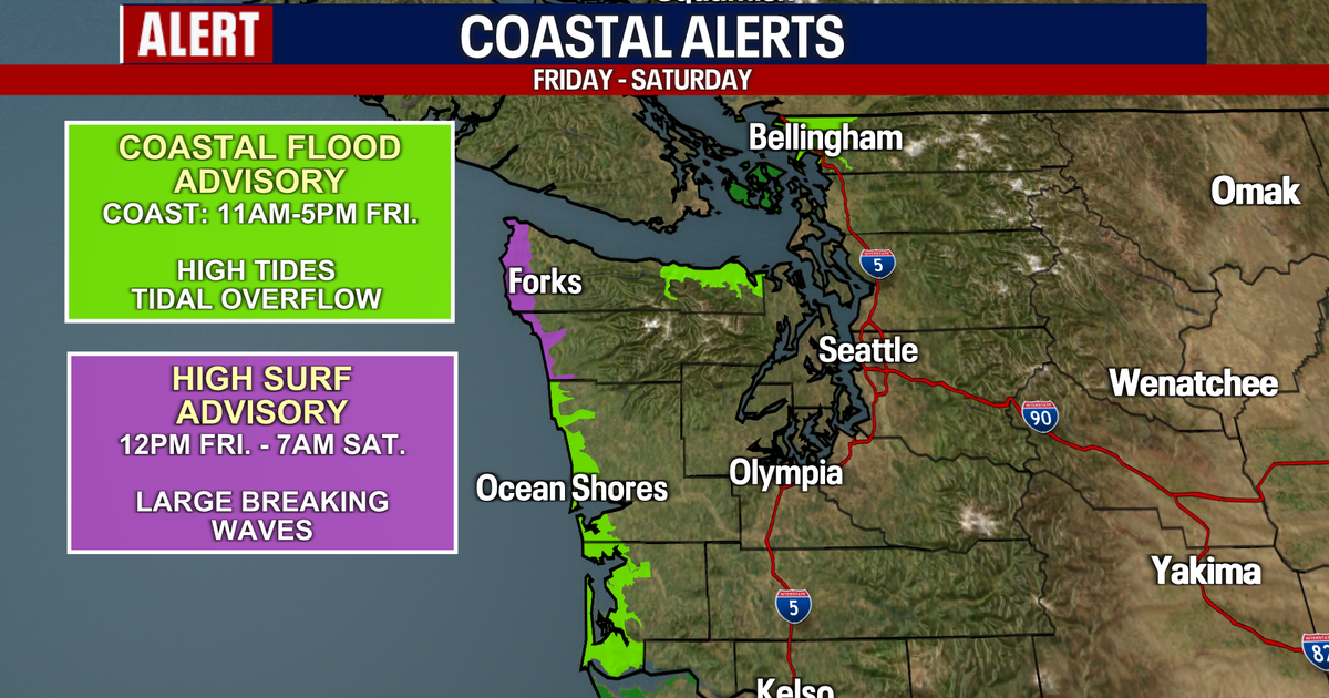
The coast is dealing with coastal flooding and large waves today, with seas building to around 20 feet reaching the coastline. A High Surf Advisory remains in effect, and beachgoers should use caution and stay well back from the water.
High surf and coastal flooding are expected through Saturday on the Washington Coast. Tonight brings scattered showers and decreasing winds, with showers continuing Friday night in Western Washington.
The next system is expected to be stronger, arriving later Saturday and continuing into early Sunday morning. Widespread rain will accompany this system, with the highest precipitation totals anticipated near the Olympic Mountains and along the coast.
Current rainfall estimates include 1.5 to 2 inches on the Washington coast, more than 3 inches on the south-facing slopes of the Olympics, and around 0.50 to 1 inch in the Puget Sound lowlands.
Winds will also drive much of Saturday's storm. Saturday afternoon and evening will bring peak coastal winds, potentially exceeding 50 mph in those areas.
Another area of concern is along the Strait of Juan de Fuca, where gusts could reach the 50 to 60 mph range. For the rest of the Puget Sound area, gusts will top out in the 30 to 40 mph range.

The strongest gusts will blow through the Puget Sound area between 9 p.m. Saturday and 3 a.m. Sunday. Winds should gradually ease Sunday as the front moves through, although scattered showers will continue.
Precipitation is expected to taper off by Sunday evening, while snow levels fall to roughly 4,000 feet. That could bring some accumulating snow to higher elevations in the Cascades, with snow levels dropping on Sunday to below the higher passes.
Drier weather is expected next week with a few showers in the mix, following the weekend system.
Related reading

How Hot CPI Data and Fed Policy Are Shifting Rates, Bonds, and Global Markets
Higher-than-expected inflation data for October 2026 forced a sharp reassessment of Federal Reserve policy as bond yields surged...
Winter Preparedness Guide: How to Protect Your Home, Family, and Pets
Cooler temperatures have arrived in Alabama, prompting tips to help residents protect their homes, communities, animals, and families...

Wyoming VFW Commander’s Felony Theft Case Dismissed After Helmet Arrest
An Air Force veteran returning from the Netherlands was arrested at Washington Dulles International Airport on July 23,...

New Mother Emanuel AME Church Memorial Opens to Honor the Emanuel Nine
A new marble memorial honoring the Emanuel Nine opens to the public on Saturday outside the South's oldest...